Google cameras capture a walk through Arlington National Cemetery
The walk through Arlington National Cemetery on a beautiful October day was being captured by Google for anyone to experience with a few keystrokes or the swipe of a smartphone screen.
Google on Sunday began its project to map the cemetery by collecting millions of photos and stitching them together to re-create the feeling of strolling the iconic burial ground of presidents and soldiers.
Online users will be able to zoom in close enough to read some grave markers. Or zoom out for panoramas of rolling hills dotted with thousands of white headstones. Or experience a 360-degree view of the resting place of America’s service members.
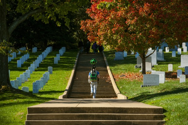
Google’s hired walker moved briskly among a light stream of visitors, carrying a backpack supporting 15 cameras encased in a green metal sphere the size of a basketball hovering above his head — a contraption known as a Trekker.
As he strolled by Section 27, where the first soldier was buried at Arlington in 1864, he stood out, a high-tech intruder among the neatly lined burial rows, where change is seen only in the new gravestones and the passing of the seasons.
“It’s the Google guys again,” said Bill Rose, visiting with his wife and 17-year-old daughter from North Salt Lake City, Utah. He said he wasn’t surprised to see someone wearing the company’s logos mapping a treasured landmark.
Cemetery officials hope the project will draw greater attention to one of the nation’s most-visited destinations, particularly the areas of the cemetery that are often overlooked.
“It’s great for people who may not be able to visit in person,” Rose said. “Being at Arlington gives you the whole perspective of why we are Americans.”
The effort is part of Google’s quest to map every nook and cranny of the Earth, an endeavor that feeds the company’s online advertising cash machine. With its car-mounted cameras, Google has captured images of just about every developed nation. It has gone to the bottom of the Grand Canyon and used a tricycle-mounted camera to navigate the stalls of Boston’s Faneuil Hall market.
Its global picture-snapping frenzy has brought charges of privacy violations in some countries. Google said it will edit out or blur the faces of people captured in photos at the cemetery.
The images will be available to the public in May for the cemetery’s 150th anniversary, honoring the day when Pvt. William Christman became the first soldier buried there, in Section 27.
“This is a tool to explore the cemetery from your home. It’s not the same as being here, of course, but for so many who can’t afford or are physically incapable of visiting, this is a great tool to get a feel for Arlington and explore its rich history,” said Jennifer Lynch, a spokeswoman for the cemetery.
Arlington National Cemetery provides online access to photos of its 400,000 above- and below-ground burial sites. Google’s images will be less granular and will capture only the gravestones close to where its Trekker passes, the company said. Given the 27 to 30 burials a day at the cemetery, Google won’t be able to display new burials and seasonal changes. Lynch said cemetery officials will work with Google on updates.
Read Full Article From The Washington Post